About Droneradar
The application meets the requirements set out in the EC Delegated Regulation 2019/945 and Implementing Regulation 2019/947 as well as the provisions set out by the Polish Air Navigation Services Agency. Droneradar is an...
The application meets the requirements set out in the EC Delegated Regulation 2019/945 and Implementing Regulation 2019/947 as well as the provisions set out by the Polish Air Navigation Services Agency.
Droneradar is an official application enabling drone operators to find their way in the complicated maze of aviation regulations. The application is integrated with PansaUTM administered by the Polish Air Navigation Services Agency. The application is supported by the Polish Civil Aviation Office (ULC).
!!! REMEMBER TO FOLLOW TIPS provided by Air Traffic Services!!!
!!! Please be sure, you enable notifications !!!
!!! Turn on location service on your phone during application installation !!!
Congratulations on purchasing your new unmanned aircraft, often called drone, RPAS, UAV, or BSP.
With the first flight, you will join the group of airspace users. Despite its small size, your unmanned aerial vehicle is an aircraft with all its associated consequences.
The most important rules of unmanned aerial vehicle movement:
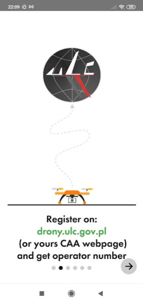
- If you are flying a drone over 250gr. or any drone with a camera, register at drony.ulc.gov.pl or on the Webpage of your CAA (Civil Aviation Authority). Enter the received Drone Operator Registration number in the Droneradar application during flight Check-In.
- Obey the rules. The iconographic images in the application illustrate what you can and what you cannot. Check their meaning out on the droneradar.eu
- Minimise the risk associated with a possible failure of your drone
- Be mind always "in front of the drone". Don't let the drone get ahead of your intentions
- Never fly near airports (the lights in the application will tell you how close you are to the airport and whether you can fly your unmanned aerial vehicle);
- Fly in sight;
- Do not fly higher than 120 m. (approx. 450 ft) AGL (Above Ground Level) in Open category. AGL stands for Over Terrain. 150 m. AGL is the minimum altitude for manned aircraft. They may not notice your drone;
- Although it is not compulsory, buy liability insurance
Are these rules enough to fly safely? Not always! You must be aware of existing air structures.
Using the Droneradar application, you can quickly and easily check if you can fly in a given place and time. Droneradar will inform you about other space users.
How does Droneradar work?
Run the application, allow location services and observe the color of the lights at the top of the screen.
GREEN - you can fly with attention to the height declared in the application.
YELLOW - there are restrictions. You can check them by clicking the signaller icon at the top of the screen. There you will find a phone number for airspace managers.
RED - no flights.
Check-In flight location registration
To inform other space users about your flights, click the Check-In. Enter your contact details and the type of drone you control. This information is voluntary, so it is worth it to be true. Confirm location. Your flying are will be marked on the Droneradar map for the indicated time.
If a flight plan is required at the selected location, log in to PansaUTM at https://utm.pansa.pl and follow the instructions.
Safe and fun flights!
Droneradar team
dlapilota.pl / droneradar Sp. z o.o. the creator of the application and reserves the right to disable the service and / or update it at any time.
Previous Versions
Here you can find the changelog of Droneradar since it was posted on our website on 2016-10-18 23:02:07.
The latest version is 2.0.899 and it was updated on 2024-04-22 14:25:36. See below the changes in each version.
Droneradar version 2.0.899
Updated At: 2021-01-30
Changes: Possibility to add an Operator and a Pilot number
Support for handling overdue Checkins in controlled airspaces (brown icon)
Support for automatic acceptance of Checkin in controlled airspaces for users with SuperPilot status
Fixed bug where NOTAM content was not displayed
Other minor fixes
Droneradar version 2.0.894
Updated At: 2020-12-29
Changes: - added support for the EC Delegated Regulation 2019/945 and Implementing Regulation 2019/947 as well as the provisions specified by PANSA
- added class support in accordance with the new regulations: Open, Special and Certified
- support for A1, A2, A3 subcategories for the Open category
- support for geographic zones
- weight categories were adjusted to the applicable regulations
- added language switch
Droneradar version 2.0.858
Updated At: 2020-02-13
Changes: Added possibility to present Operator phone number to the other users
Added option to register a flight in forbidden airspaces
Added weather information (Premium version)
Overall compatibility with the Android OS has been increased
Many minor improvements have been implemented
Droneradar version 2.0.842
Updated At: 2019-12-13
Changes: 1. The overall application stability has been improved
2. Added saving of entered fields
3. The map display and menu navigation have been improved
4. The "jumping" map when catching FIX GPS has been eliminated
5. There have been many improvements regarding functionality and smoothness of operation
Known Issues:
1. Zone disappearance, we diagnose the problem, solution -> phone restart
2. Crash occurring when moving the map on devices with ardeno GPU. We are waiting for the 3rd party fix.
Droneradar version 2.0.835
Updated At: 2019-12-01
Changes: Critical application fixes, and:
1. Improved airspace display
2. Fixed a bug related to high zoom, during which incorrect indications of the three-color indicator appeared
3. Fixed address search bug
5. Added side bar launcher on the left side of the screen
6. Added the ability to debug the application in case of problems
Please update
Droneradar version 2.0.829
Updated At: 2019-11-28
Changes: DroneRadar 2.0
1. A completely new version of the application, with a new improved map display
2. Full integration with PansaUTM
3. Improved GPS support
4. Support for two-way, non-verbal CDDLC (Controlled Drone Data Link Communication)
5. Improved user interface
6. Support for VLOS and BVLOS missions defined in PansaUTM
7. The official source of all aeronautical structures from PANSA
8. Contextual system of hints and amenities
Droneradar version 1.6.673
Updated At: 2018-09-27
Changes: - Added grouping of airspaces in places where they overlap (multiplier x[number of airspaces] will appear in Info tab)
- A permission number field in flight registration (Check-In) process, has been added
- Added RPA zones support in CTR zones (RPA airspaces will be added on October 5th)
- Some minor improvements
Droneradar version 0.3.354
Updated At: 2016-10-08
Changes: Added support for 1km and 6km zones for non-controlled airports,Improved communication UAVO service ATS,General improvement of application
Disclaimer
Official Google Play Link
We do not host Droneradar on our servers. We did not scan it for viruses, adware, spyware or other type of malware. This app is hosted by Google and passed their terms and conditions to be listed there. We recommend caution when installing it.
The Google Play link for Droneradar is provided to you by apps112.com without any warranties, representations or guarantees of any kind, so access it at your own risk.
If you have questions regarding this particular app contact the publisher directly. For questions about the functionalities of apps112.com contact us.